

Built for every part of the journey, Overlander is a rugged, all-terrain navigator that can easily switch from turn-by-turn directions for on-road navigation to topography maps for off-grid guidance in North and South America.
Overlander features integrated pitch and roll angles as well as a compass, altimeter and barometer to help you and your vehicle navigate difficult terrain. A built-in rechargeable battery means you can even take it beyond your vehicle.

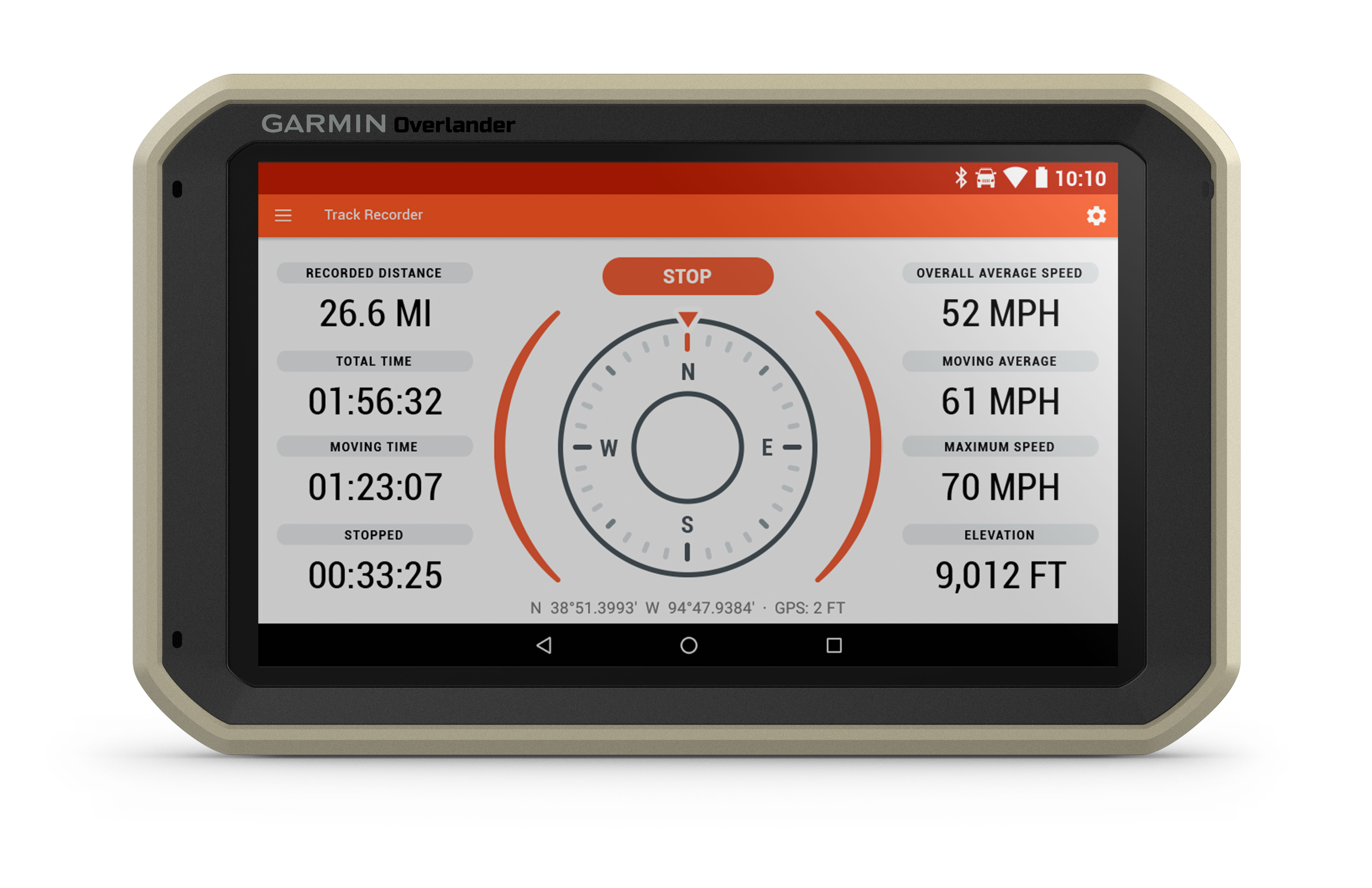
Create a Garmin Explore™ account to plan and map out your next adventure. You can easily record and create routes by tapping the screen on your Overlander navigator. Use your account to wirelessly sync — via Wi-Fi® connectivity¹ — your tracks, routes and waypoints across all your devices.

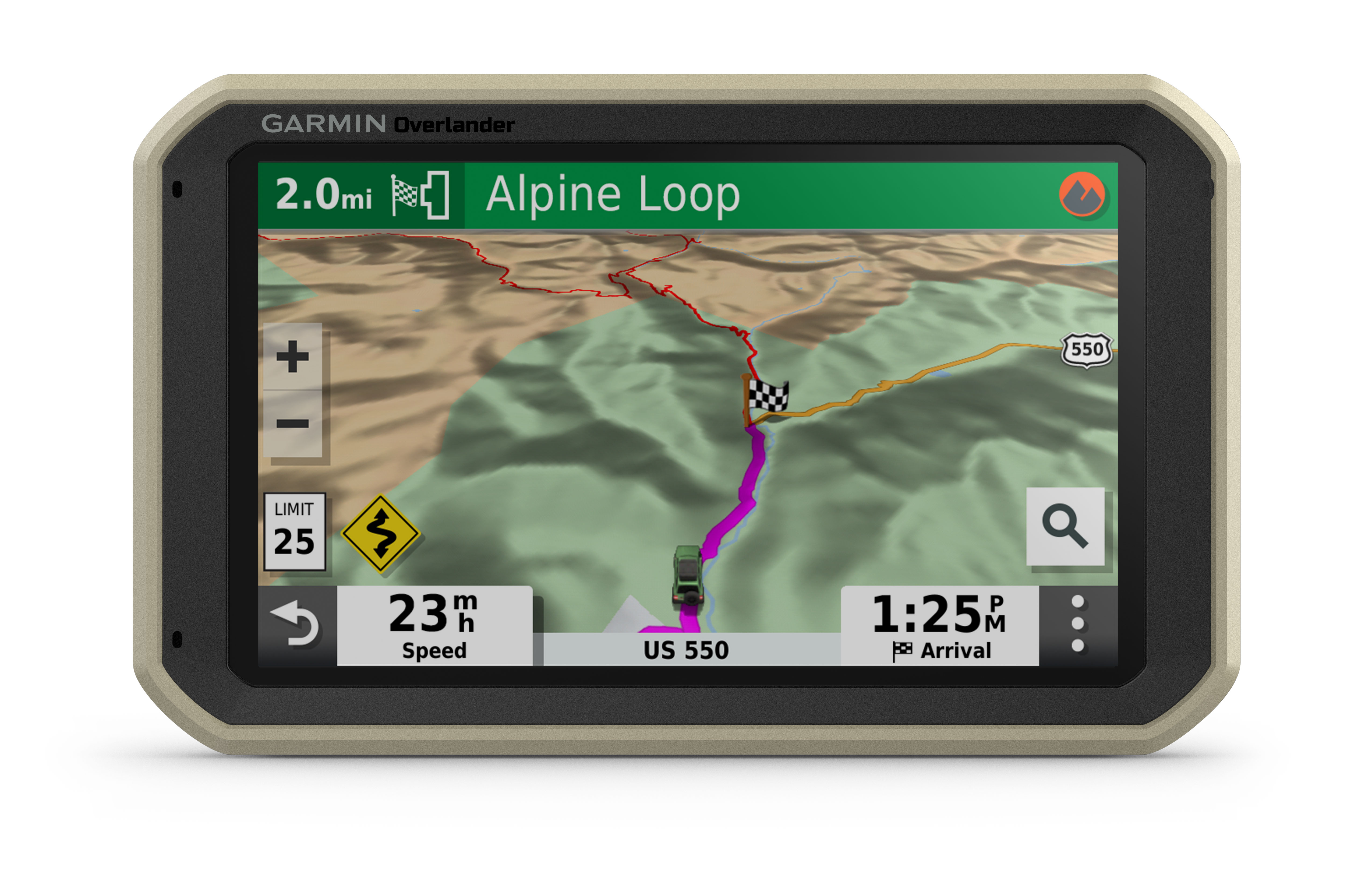
On/Off Road
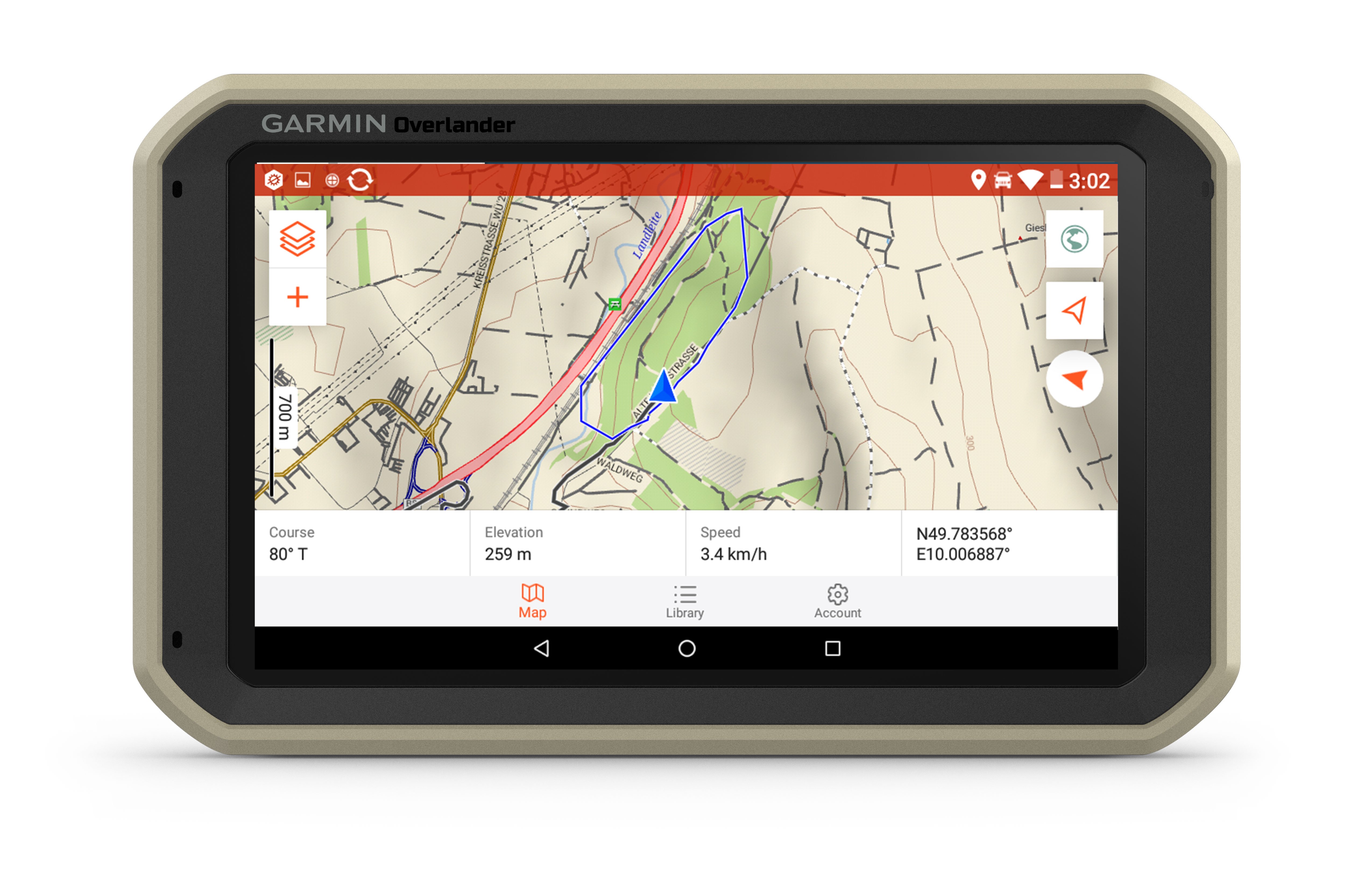
7” color touchscreen features turn-by-turn directions for on-road navigation and topography maps for off-road guidance covering North and South America.
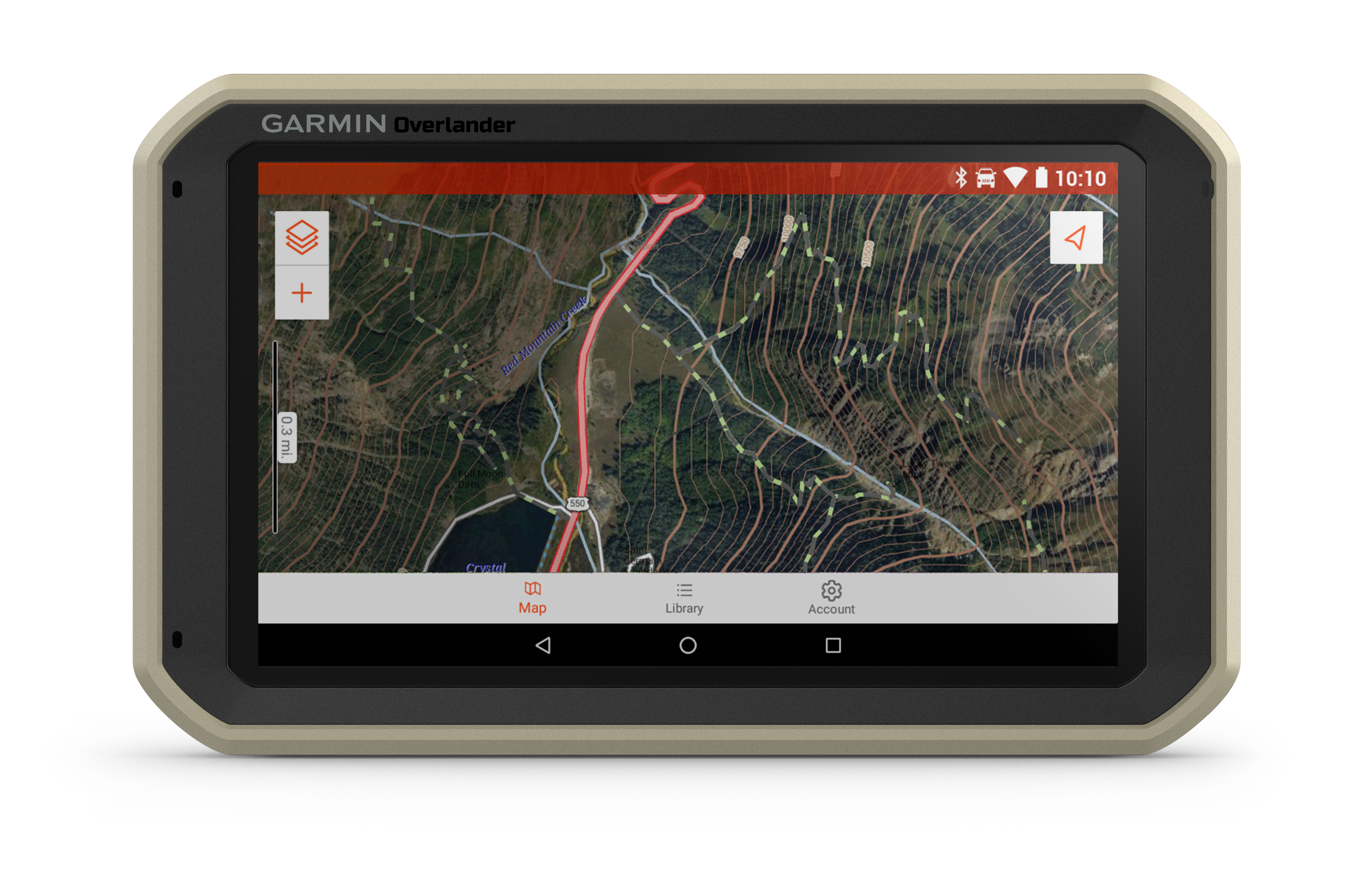
Garmin Explore
Use the Garmin Explore app to download additional maps and USGS quad sheets on 64 GB of storage, and sync all of your data between devices¹.
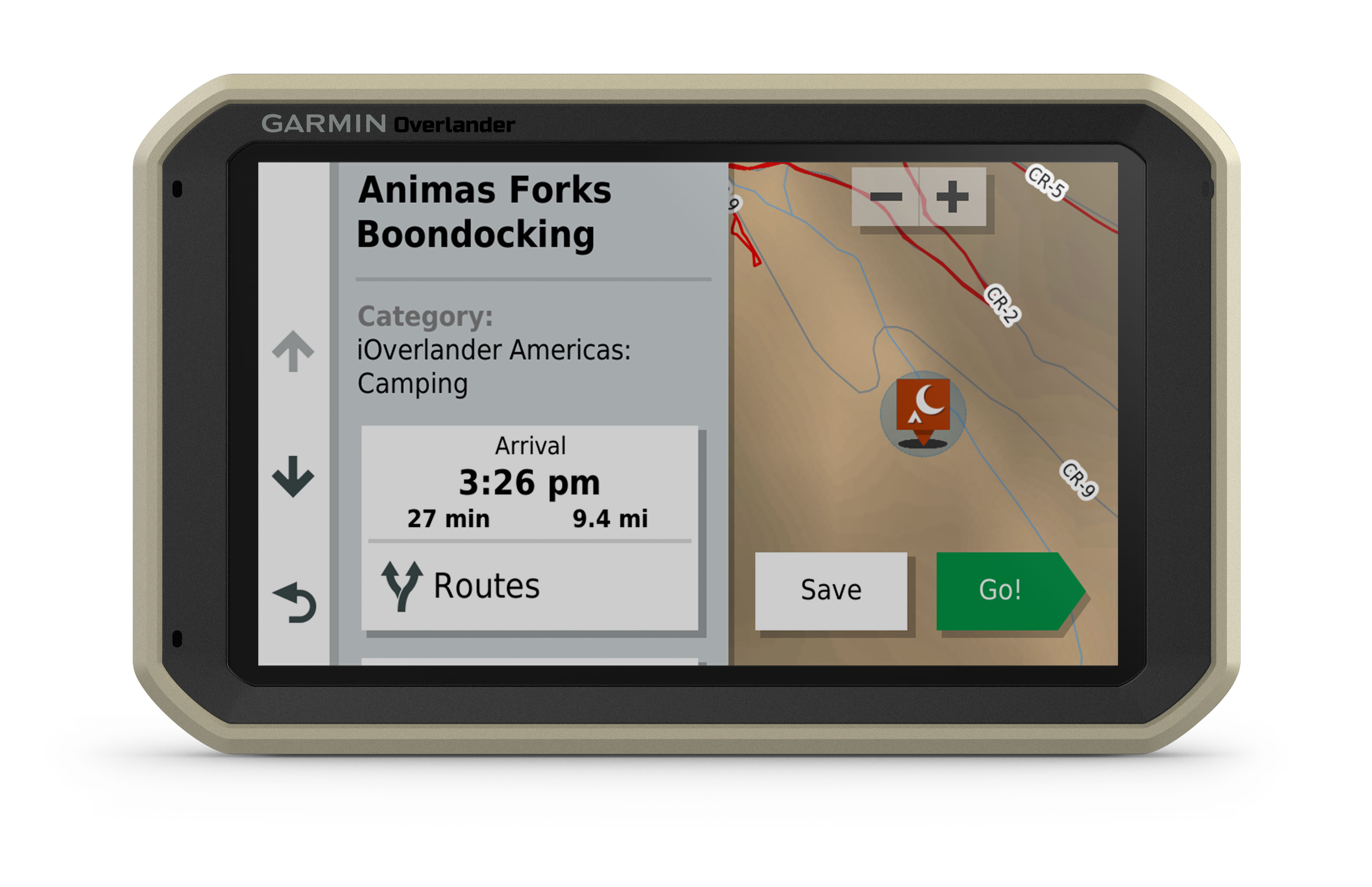
Find Campsites
Preloaded with iOverlander™ points of interest (POIs) and Ultimate Public Campgrounds, so you don’t need a cell signal to find the best-established, wild and dispersed campsites.
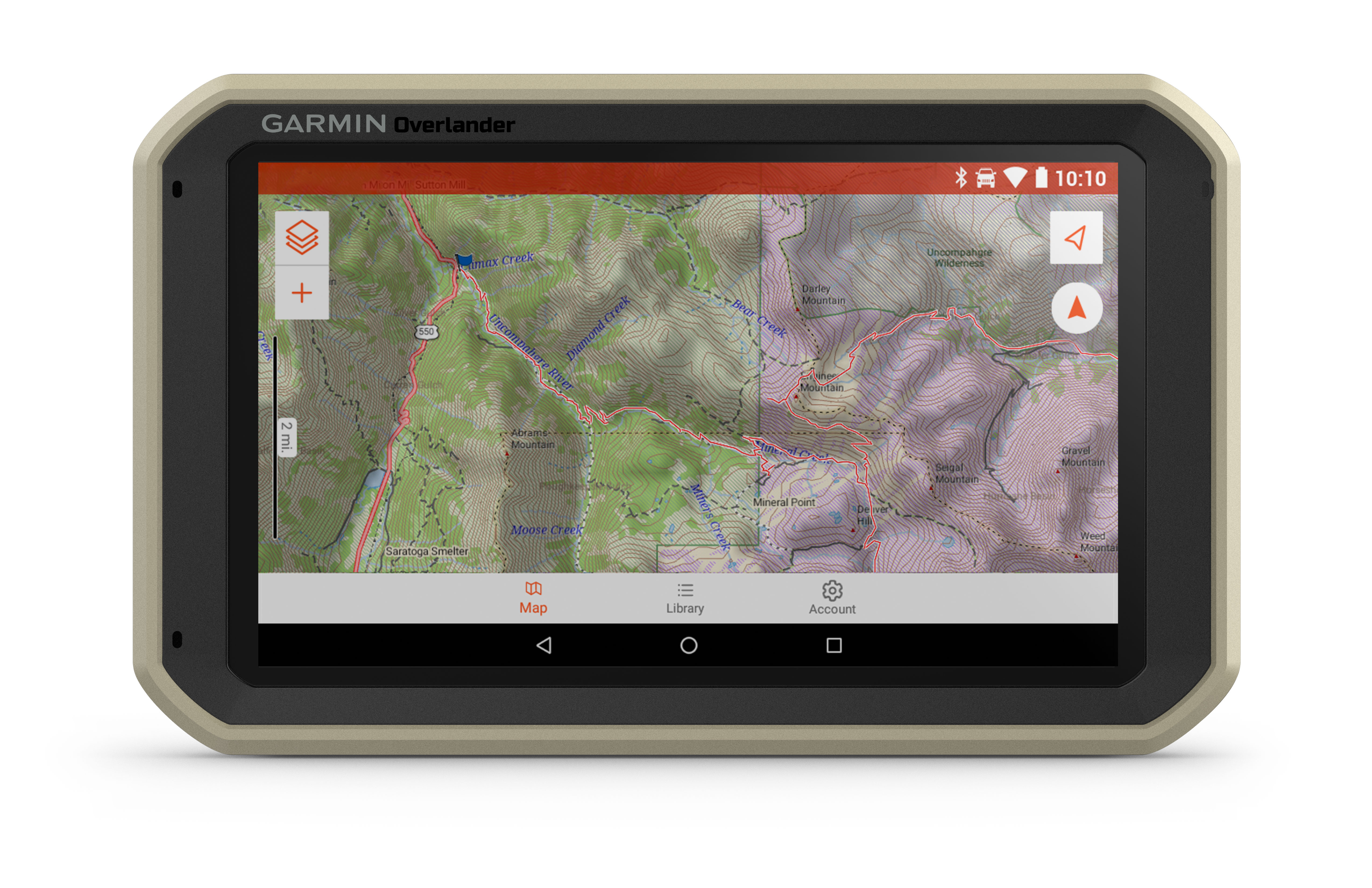
Find Boundaries
Features topographic maps with public land boundaries and 4x4 roads.
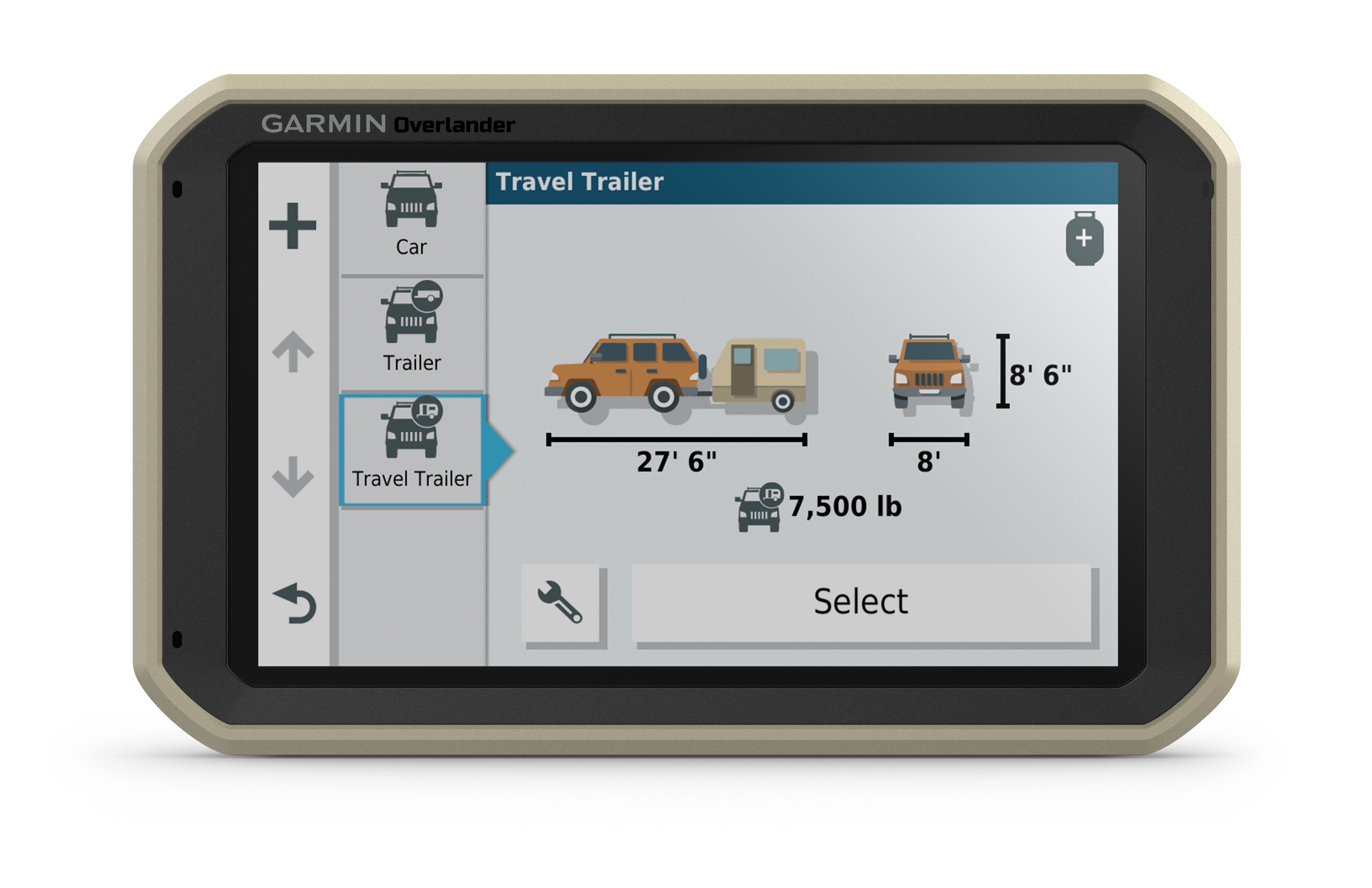
Know Your Vehicle
Customized street navigation for the size and weight of your truck, plus alerts for upcoming bridge heights, weight limits, sharp curves, steep grades and more.
RAM Mounted
Can be mounted anywhere with a powered magnetic mount that comes with a suction cup or RAM-compatible adapter.
InReach® Compatible
Pairs with inReach satellite communicators² (sold separately) for two-way text messaging, interactive SOS and weather forecasts.
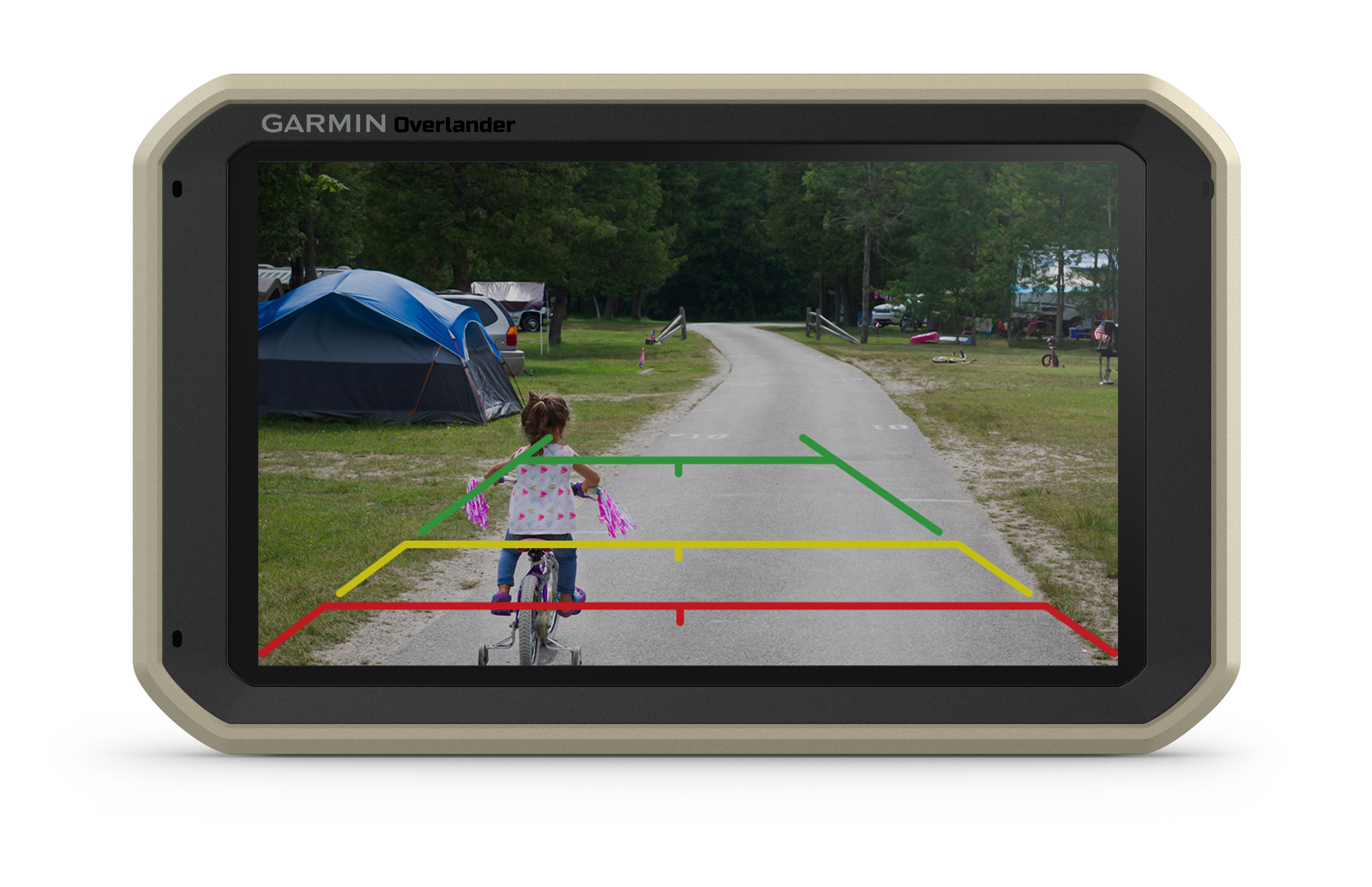
BC™ 35 Compatible
Pairs with up to four BC 35 backup cameras (sold separately) so you can see what’s behind you.
Multi-GNSS Support
GPS, GLONASS and Galileo support helps track in more challenging environments than GPS alone.
¹Requires an active Wi-Fi connection
²Active satellite subscription required for inReach device
Wi-Fi is a registered trademark of the Wi-Fi Alliance.